


Le tour des cascades a

babouille
User
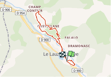

Length
8.5 km

Max alt
1097 m

Uphill gradient
332 m
Km-Effort
12.9 km

Min alt
862 m

Downhill gradient
330 m
Boucle
Yes
Creation date :
2020-10-15 09:33:52.0
Updated on :
2020-10-15 13:07:28.936
2h39
Difficulty : Medium

FREE GPS app for hiking
 SityTrail
IGN / Geographical institutes
SityTrail Plus
The world is yours!
About
Trail Walking of 8.5 km to be discovered at Provence-Alpes-Côte d'Azur, Alpes-de-Haute-Provence, Le Lauzet-Ubaye. This trail is proposed by babouille.
Description
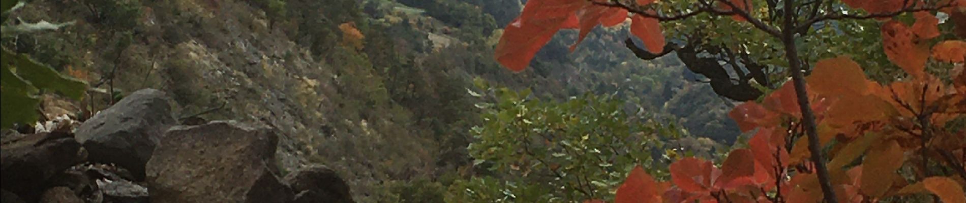
Au Lauzet. Ubaye , au Tabac descendre au pont romain et suivre le sentier des cascades jusqu’à Champ Contier. Puis redescendre .
Photos


Positioning
Country:
France
Region :
Provence-Alpes-Côte d'Azur
Department/Province :
Alpes-de-Haute-Provence
Municipality :
Le Lauzet-Ubaye
Location:
Unknown
Start:(Dec)
Start:(UTM)
296027 ; 4922370 (32T) N.
Comments